Elk Creek Watershed Maps
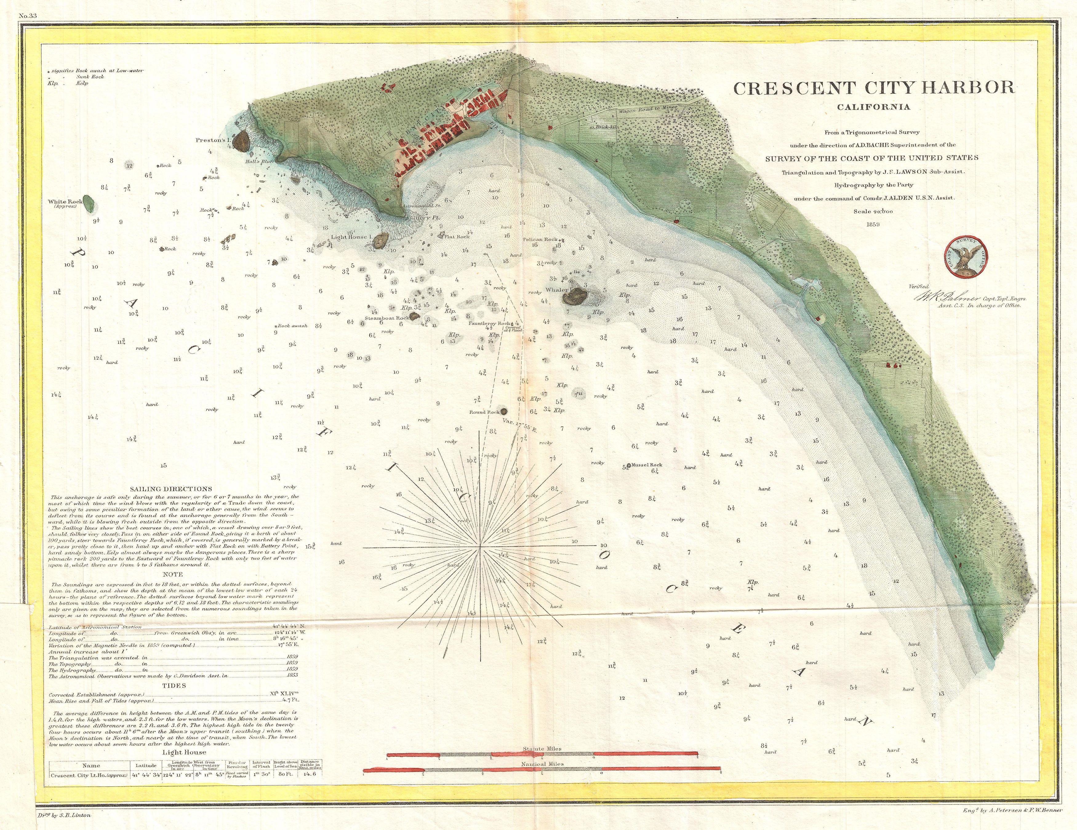
Crescent City 1859
Coast survey map of Crescent City and the lower portion of Elk Creek as interpreted in 1859. The lower stream and estuary channels were further west in 1859 than today. DOWNLOAD (3500x2697px)

Topography
Topography of the lower Elk Creek watershed including an old mill pond, oxbow lake, current main channel of Elk Creek, and two tributaries that flow adjacent to the old mill site and through oxbow lake before reaching Elk Creek. Green indicates lower elevations and red colors indicate higher elevations. Area marked in purple indicate t DOWNLOAD (1431x1102px)

Salmonid Sampling Efforts
Juvenile salmonid detections in Elk Creek watershed during WY2020 (Smith River Alliance and Stillwater Sciences 2021) and from 2013 to 2018 by CDFW (Garwood 2019). DOWNLOAD (1507x1136px)

Location of Streams & Road Crossings
Location of streams and road crossings in the Elk Creek watershed. Public property is located in and adjacent to the basin in Del Norte County, CA. DOWNLOAD (1431x1102px)